The Nissan Tram Face will now be comprised of two days of competition in order to provide the best conditions possible to the riders coming from around the world to the second stage of the Freeride World Tour. The first day of competition is now scheduled for Friday, February 27th. There are two faces possible for this stage opening: Silverado and National Geographic Bowl. For now, the weather conditions are good in Squaw Valley USA, however, the predictions show a storm front coming through during the weekend. The organizers have decided to go ahead with a first day of competition leaving a window for a second day on the mythical Tram Face early in the week. For the Freeride World Tour organizers, the snow conditions on the chosen face thus the riders’s security are key. This decision was made by the organizers in cooperation with local mountain guides. More info on Squaw’s Tram Face Comp.
Category: News (Page 26 of 30)
Wet weather started the week before Presidents’ Day, breaking a long dry spell and dumping almost eight feet of snow on Squaw’s upper mountain. The skiing for the next two weeks was insanely good. There was the epic bluebird day on Tuesday, February 17th (which I missed for babysitting duty) and deep backcountry conditions which were irresistible and also dangerous; last Friday these guys witnessed a huge slide in the Cabin Creek area. I got a new video camera, the Flip HD Mino, which is tiny and light and takes great quality video and audio. I made My First Ski Video … now I just need to work on finding the good light and keeping my hand steady. The rain came in yesterday morning and has stuck around melting out and dirtying up the precious snow. Fortunately a winter weather advisory is back in effect and snow is forecast throughout the week. The long-anticipated tram face contest is happening this week at Squaw. It should make for some exciting spectating from the parking lot or one of the higher streets in the Valley. We’re planning on heavy-duty duty tailgating and video-reporting so check back here for updates.
For years, my husband has kept a small calendar in his closet where he marks each day he skis and which of them are powder days. From this, he keeps a running tally of his powder percentage each season. I’m not sure whether he’ll ever abandon the old, simple system, but I recently came across a new website that might propel him into the 21st century. SkiLogs.com lets you keep an online journal of your ski days including the date you skied, the conditions, the weather and the lifts you rode. You can also upload photos from the day, track the exact time that you skied, and note the wind speed and direction. The site also has a vertical calculator for Squaw Valley; enter the lifts you skied and the number of laps on each and it calculates your vertical for the day.
![]()
A WINTER STORM WARNING FOR HEAVY SNOW AND BLOWING SNOW REMAINS IN EFFECT UNTIL NOON PST THURSDAY.
* SNOW WILL INCREASE OVER THE SIERRA THIS MORNING WITH PERIODS OF HEAVY SNOW THROUGH THURSDAY MORNING.
* TOTAL SNOW ACCUMULATIONS OF 12 TO 20 INCHES OF SNOW IS EXPECTED AT LAKE LEVEL…WITH 20 TO 40 INCHES ABOVE 7000 FEET.
* SOUTHWEST WINDS OF 15 TO 30 MPH WITH GUSTS OF UP TO 50 MPH TONIGHT AND THURSDAY WILL CREATE AREAS OF BLOWING AND DRIFTING SNOW. RIDGE GUSTS OF UP TO 140 MPH ARE POSSIBLE.
* RAD DOGS SHOULD EXPECT EXTREME HUCKING AND STRAIGHT RUNNING CONDITIONS AT LOCAL SKI AREAS THURSDAY AND FRIDAY. NEW SNOW TOTALS SHOULD MAKE TURNS UNNECESSARY. SKIING WITH A BEACON AND A BUDDY ARE RECOMMENDED TO AVOID POTENTIAL FATALITIES FROM SNOW SUFFOCATION. APRES SKI SHOTS AND BEERS ARE STRONGLY ENCOURAGED TO CALM NERVES AFTER ROWDY DISPLAYS OF SICKNESS AND VORACIOUS PURSUITS OF GNAR POINTS.
* CONDITIONS COULD TURN TO RAIN BY THE WEEKEND SO GET IT WHILE IT’S HOT.
A Special Weather Statement from NOAA.gov calling for “significant snow accumulations”:
...CHANGE TO WINTER CONDITIONS THIS WEEKEND...

HIGH PRESSURE OVER THE WEST COAST WILL MOVE INTO THE CENTRAL
PACIFIC ON THURSDAY AND FRIDAY. THIS WILL ALLOW ARCTIC AIR TO
MOVE SOUTH FROM ALASKA AND NORTHERN CANADA AND LOWER HIGH
TEMPERATURE READINGS FROM FRIDAY TO SUNDAY BY 20 TO 30 DEGREES.

THE INITIAL BLAST OF COLD AIR IS FORECAST TO REACH THE AREA LATE
FRIDAY OR EARLY SATURDAY AS A STRONG COLD FRONT MOVES INTO
NORTHERN CALIFORNIA AND NORTHWEST NEVADA. AHEAD OF THE
FRONT...WINDS WILL INCREASE AND ARE LIKELY TO BE STRONG AT TIMES
ESPECIALLY OVER THE SIERRA AND ALONG THE HIGHWAY 395 CORRIDOR.
THE FRONT SHOULD MOVE SOUTH AND EAST OF THE AREA BY LATE SATURDAY
AFTERNOON.

THERE IS A CHANCE FOR VALLEY RAIN AND MOUNTAIN SNOW ALONG THE
FRONT. RAIN WILL ONLY OCCUR AHEAD OF THE FRONT...AS SNOW LEVELS
QUICKLY DROP TO VALLEY FLOORS ONCE THE FRONT PASSES. SIGNIFICANT
SNOW ACCUMULATIONS ARE NOT FORECAST TO OCCUR IN THE SIERRA OR
WESTERN NEVADA WITH THIS FRONT.

COLD AIR REMAINS IN PLACE INTO EARLY NEXT WEEK WITH THE MAIN
STORM TRACK FROM THE NORTH. MODELS ARE INDICATING A STORM COULD
AFFECT THE SIERRA AND WESTERN NEVADA SUNDAY THROUGH TUESDAY. THIS
CREATES THE POTENTIAL FOR SIGNIFICANT SNOW ACCUMULATIONS EARLY
NEXT WEEK AS THE STORM COULD PERSIST FOR A DAY OR TWO.
I have to stay home with the baby, but for God’s sake, someone please go to the Snow God’s Ball in Squaw Valley and sacrifice something precious for me.
Hosted by Squaw Valley Ski Patrol, the 17th Annual Snow Gods Ball starts at 8 in the Plaza Bar on Saturday, December 20. Raffle prizes include Squaw Valley USA Midweek Season Pass, lift tickets, ski and snowboard gear, and more.
Snow Gods Ball headlining act, Monophonics, bring a unique blend of old school soul/funk and rare groove. Since coming together in 2005, they have quickly evolved into one of the hottest live instrumental funkbands in the Bay Area. Recognized for their retro sound, style, and approach (primarily inspired by late ’60s and early ’70s artists like The Meters, The J.B.’s,The and Crusaders), these young heavy-hitters aim to spread live, instrumental dance music as well as represent and continue the tradition of California/Bay Area soul, jazz and funk. They have just finished recording their second album featuring vocalist Marcus Scott and special guest Karl Denson which is scheduled to be released in 2009. www.monophonics.com
Tickets to the Snow Gods Ball are $15 in advance and $20 at the door. Tickets can be purchased in advance by calling Squaw Valley Ski Patrol at 530-581-7260. More information about this year’s celebration is also available by calling 530-581-7260.
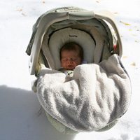
So I’ve taken a little time off from writing here to have a baby. The little snow monkey was born on October 13th and experienced his first snow storm last night. Truckee is blanketed in white and Squaw is reporting 14 inches of snow.
Here’s a photo of Eagle’s Nest so filled it that it almost looks easy…
See more photos of Squaw Valley USA >
Also, here’s a link to another Tahoe ski blog with some great weather links >
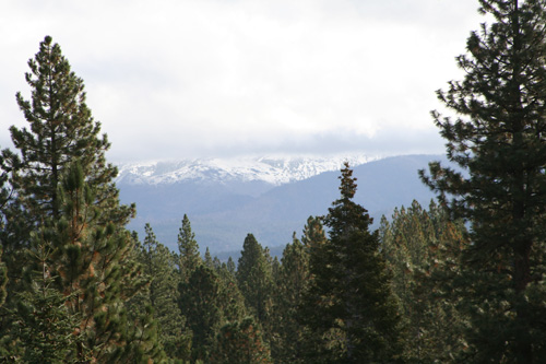
I woke up this morning to see the first snow of the season on top of Mt Rose. Photo taken from my front door. Bring it on!
Squallywood author, Robb Gaffney just announced the dates for his 2008-09 Squallywood clinics. He’ll offer two tw0-day “beefed-up” clinics and one two-day “light” version. Check out the Squallywood site for details. View the 2008 Squallywood Clinic video.
On Saturday Sept. 6th, Shane McConkey will be at the Perrine Bridge Festival in Twin Falls, Idaho participating in a charitable base jumping event to raise money for children with special needs. He and several other base jumpers will jump from 10 am to 6 pm doing between ten and seventeen base jumps. Shane is asking you to raise money for these children by pledging a per jump $ amount. It is for a good cause and is, of course, tax deductible. Visit the festival website.
Example:
You pledge $50 per jump. Shane does 12 jumps in the 8-hour time frame. Your donation would be $600. Easy math right! You can pledge any amount you like. It doesn’t have to be a large amount as long as we raise some money for the kids. Email if you want to participate.


Recent Comments